
Product
VISTA — Spatial Tracking App
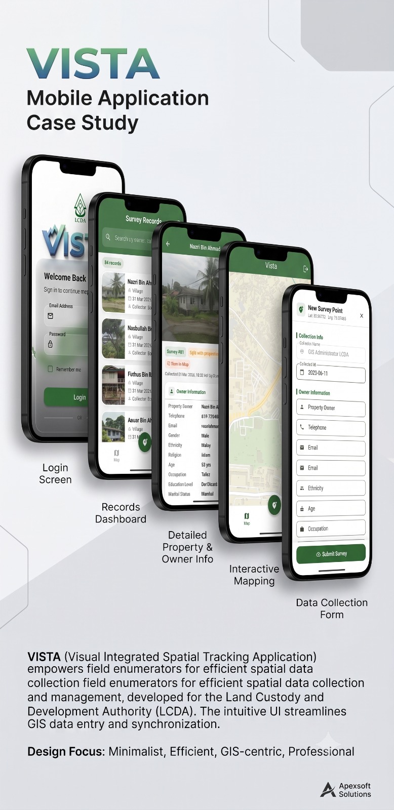
Visual Integrated Spatial Tracking Application for field enumerators. Built for LCDA to streamline GIS data entry, property surveys, and spatial data synchronization in the field.
Key Capabilities
- Interactive GIS Mapping
- Field Data Collection Forms
- Survey Records Dashboard
- Detailed Property & Owner Profiles
- Secure Login & Role Management
- Real-time GPS Survey Points
- iOS & Android (Cross-Platform)
- Offline-Ready Synchronization